FIREAI-OPS
FIREAI-OPS transforms Earth Observation, UAV, IoT and meteorological data into predictive wildfire intelligence, combining AI–physics simulation, autonomous sensor coordination and 3D operational environments for faster, more informed emergency response.


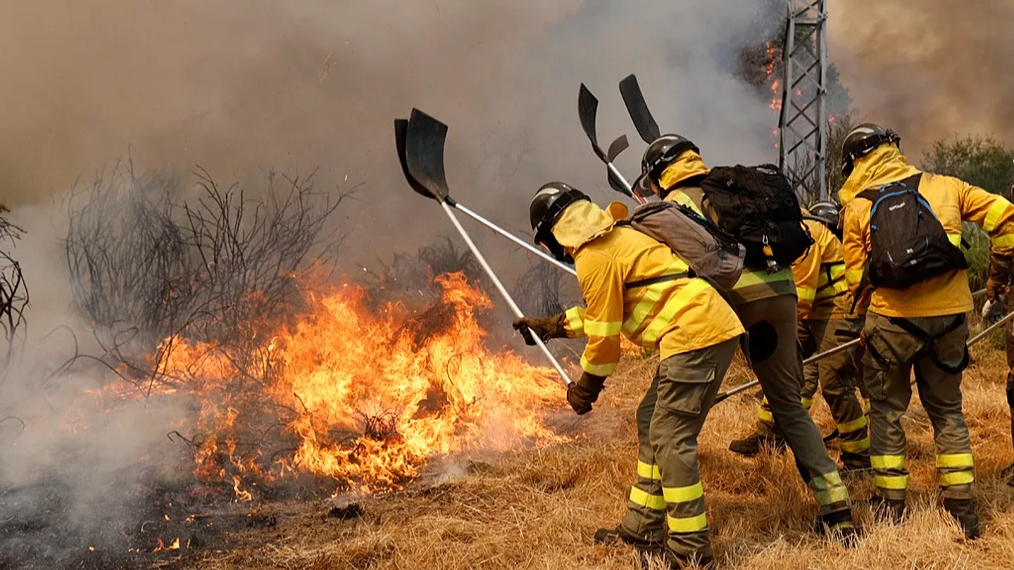
Wildfire operations unfold in environments where conditions can change within minutes. Yet emergency teams often work with fragmented information from satellites, UAVs, terrestrial sensors and meteorological systems, while manual observation tasking can delay situational awareness and keep decisions reactive.
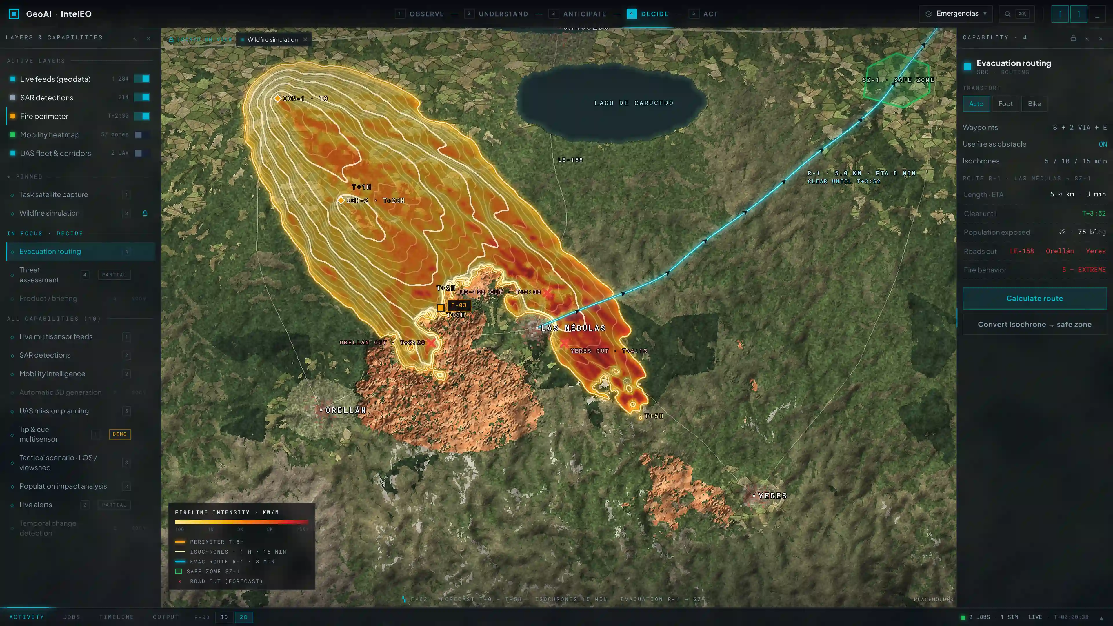
FIREAI-OPS creates a unified operational environment that continuously combines Earth Observation, airborne, ground-sensor and weather data with predictive intelligence. The platform is designed to help emergency agencies anticipate fire evolution, coordinate observations and resources, and maintain a shared operational picture as conditions develop.
Developed within ESA’s InCubed programme, FIREAI-OPS is one of eight Earth Observation wildfire applications selected through the 2026 joint ESA InCubed–Spanish Space Agency initiative, created to strengthen risk anticipation, early detection and action during critical wildfire situations.

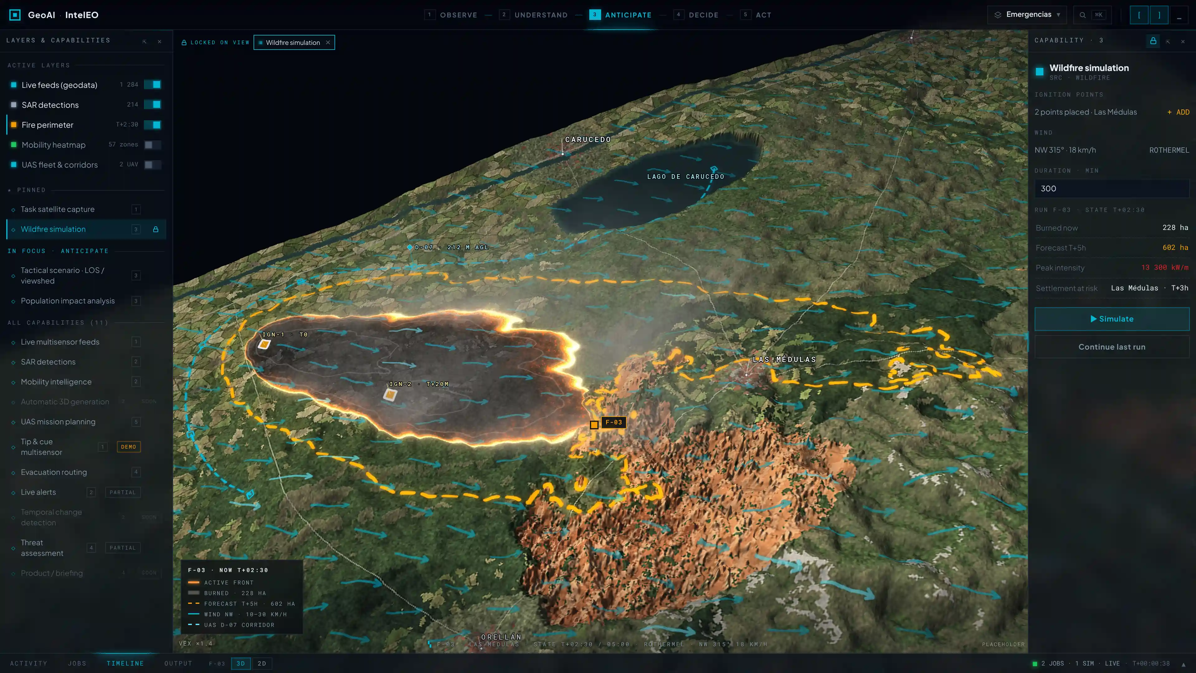
FIREAI-OPS builds on IntelEO™, GeoAI’s sovereign operational geospatial intelligence platform, extending its multi-source data ingestion, AI orchestration, predictive analytics and immersive visualisation capabilities into a dedicated wildfire operations environment.
Four interconnected capabilities transform the IntelEO™ ecosystem for this mission:
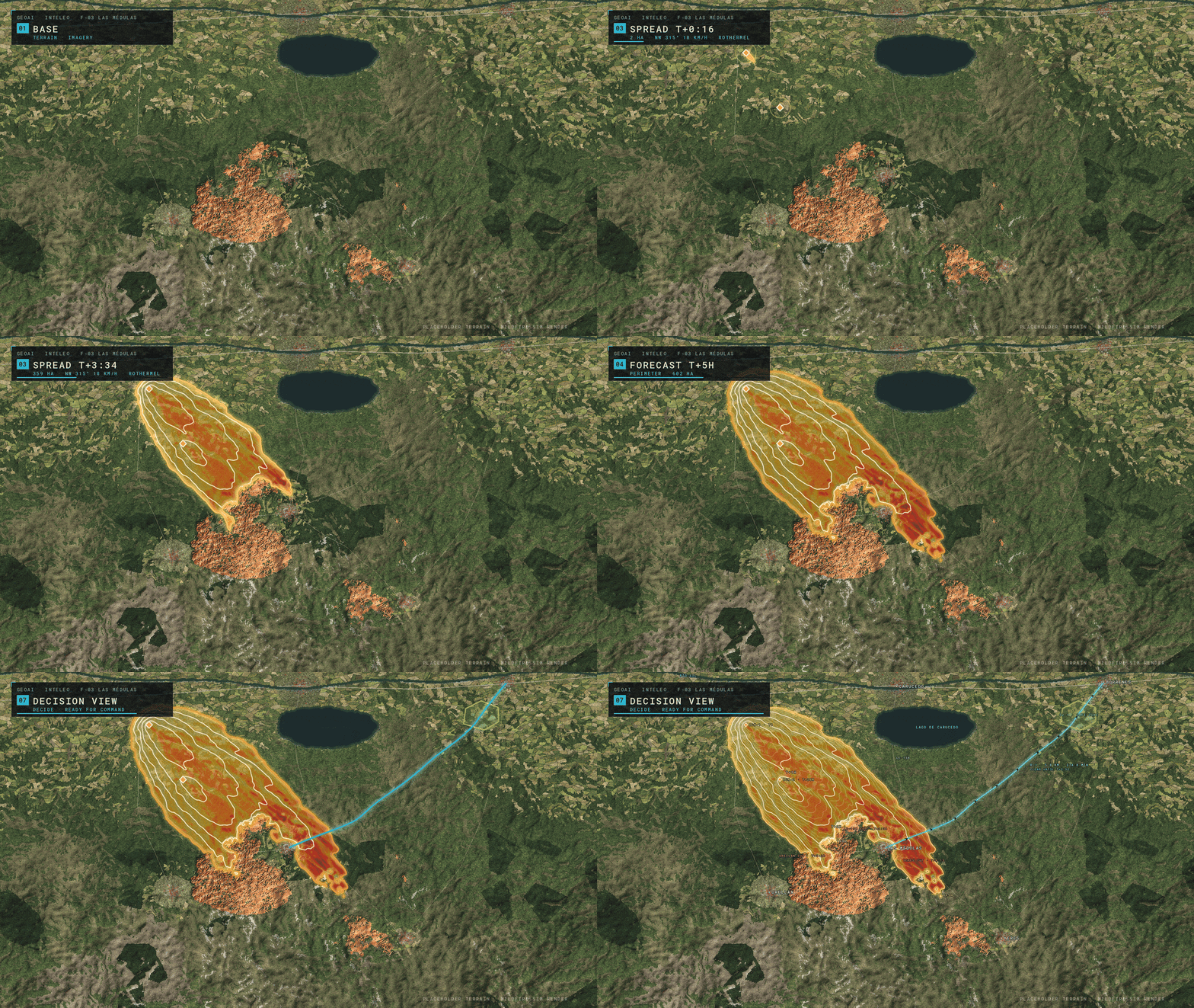
FIRE-SIM combines established fire-behaviour models with physics-informed artificial intelligence to model fire propagation, intensity and energy release.
SIGIS coordinates and tasks satellites, UAVs and IoT sensors dynamically, reducing the time between operational needs, observation and updated intelligence.
FIRE-DATAHUB integrates and synchronises Earth Observation, meteorological, UAV and terrestrial datasets—including sources such as Copernicus, PNOA, AEMET and IGN—into a continuously updated data environment.
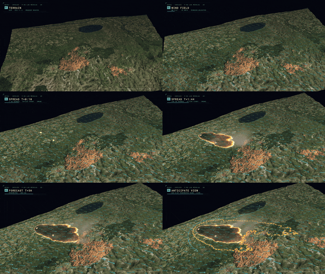
FIRE-OPS 3D transforms these data and forecasts into an operational digital twin where command centres can visualise fire evolution, explore scenarios and support mission planning spatially.
Quantum-inspired optimisation from Multiverse Computing supports efficient AI inference, while CATEC contributes UAV capabilities and validation. Together, these technologies extend IntelEO™ from geospatial data fusion into a specialised operational system for predictive wildfire management.
FIREAI-OPS is developed around the operational requirements of organisations directly responsible for wildfire response. Spain’s Unidad Militar de Emergencias (UME) and INFOCA participate as operational users, connecting platform development with the realities of command centres, aerial operations and field response.
The 18-month activity combines user requirements, system integration, software- and hardware-in-the-loop validation with CATEC UAVs, and operational demonstration under representative wildfire conditions. This validation pathway targets TRL 8 while building on the TRL 7 heritage of IntelEO™.
The result is an operational intelligence framework focused not only on understanding where a wildfire is, but on anticipating how it can evolve, identifying where new observations are needed and helping decision-makers coordinate resources around a continuously updated picture of the emergency.
- Transform fragmented Earth Observation, UAV, IoT and meteorological feeds into a continuously updated common operational picture.
- Anticipate wildfire propagation, intensity and behaviour through hybrid AI–physics modelling.
- Automate the coordination and tasking of satellites, UAVs and terrestrial sensors according to evolving operational needs.
- Deliver spatially accurate 3D environments for situational awareness, mission planning and operational training.
- Reduce the time between observation, analysis and decision-making during fast-moving wildfire events.
- Support near-real-time and edge-ready AI inference through quantum-inspired model optimisation.
- Validate the platform with operational users including UME and INFOCA under representative wildfire-response conditions.
- Extend IntelEO™ into a sovereign European decision-support environment for wildfire and emergency operations.
Tutorial: Masked Portfolio Splitscreen Scroll Animation
In this Webflow tutorial, Jonas Arleth shows how to create a masked scroll animation with a split screen effect over the text. He explains how to analyze and recreate the animation. He covers various elements such as navigation, text shift and background color. He also shows how to move the text in the animation and gives tips for optimization.
Seen at: https://pioneer-portfolio.webflow.io
Technologies Used
- IntelEO™ sovereign operational geospatial intelligence platform
- Multi-source Earth Observation, UAV, IoT and meteorological data fusion
- Hybrid AI–Physics wildfire modelling
- Physics-Informed Neural Networks and predictive analytics
- Automated satellite, UAV and sensor tasking
- 3D Operational Digital Twin
- Quantum-inspired AI optimisation
- Cloud, on-premise and edge-ready deployment
- Copernicus, PNOA, AEMET and IGN data integration
- DIAS / DestinE-compatible geospatial architecture
Key Results
- Integrated FIREAI-OPS architecture built around the IntelEO™ operational intelligence ecosystem.
- Dedicated FIRE-SIM, SIGIS, FIRE-DATAHUB and FIRE-OPS 3D capabilities for wildfire operations.
- Unified framework for continuously assimilating satellite, UAV, IoT and meteorological information.
- Hybrid AI–physics modelling architecture for predicting fire propagation, intensity and behaviour.
- Automated multi-sensor coordination designed to shorten observation-to-decision cycles.
- Operational validation framework involving UME, INFOCA and CATEC, targeting TRL 8.
- Secure and interoperable architecture designed for European Earth Observation and emergency-management environments.
Impact
- Faster situational awareness during rapidly evolving wildfire events.
- A shift from reactive response towards predictive, intelligence-led operations.
- Better coordination of aerial, terrestrial and space-based observation resources.
- Improved decision support for emergency commanders and field operators.
- Greater protection of people, critical infrastructure, assets and natural ecosystems.
- Reduced fragmentation between Earth Observation, sensor information and operational systems.
- Expansion of IntelEO™ into a scalable European framework for wildfire intelligence and disaster response.